
cl_maintenanceAndUpdateFrequency
annually
3 record(s)
Type of resources
Topics
Keywords
Contact for the resource
Provided by
Years
Formats
Representation types
Update frequencies
Status
Scale
GEMET keywords
-
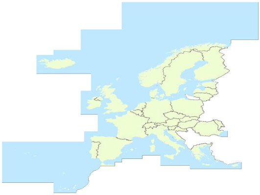
EuroRegionalMap is a Pan-European topographic vector dataset at scale 1: 250000 covering 32 European countries: 26 EU Countries (Bulgaria not included), 4 EFTA countries, the Republic of Moldova and Liechtenstein. It is seamless and harmonized across boundaries.It is a seamless1 and harmonised data and is produced in cooperation by the National Mapping and Cadastral Agencies of Europe, using official national databases. EuroRegionalMap is ideal for a wide range of uses, including cartographic publishing and backdrop visualisation, or in combination with other datasets for marketing planning and socio-economic analysis, environmental analysis, and transport management. Themes: a) Administrative (administrative boundaries, administrative areas) b) Hydrography (well, coastline / shoreline, foreshore, island, sea, aqueduct, lake / pond, reservoir, spring / water hole, waterfall, watercourse, dam / weir, lock, glacier, snow field / ice field, wetland) c) Transportation (railway, interchange of motorways, road, control tower, level crossing, ferry crossing, ferry station, entrance / exit, railway station, vehicle stopping area / rest area, pier / wharf / quay, airport / airfield, heliport, runway) d) Settlements (built-up area, named location)
-
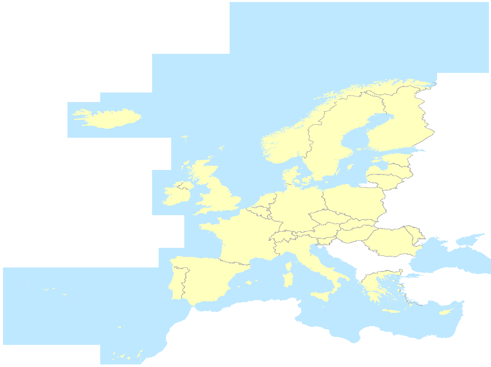
EuroRegionalMap v4.0 is a pan-European dataset containing topo-geographic information at the scale 1:250 000 assembled from 31 country data sets covering 26 EU Countries (Bulgaria not included), 4 EFTA countries, the Republic of Moldova. It is a seamless (there are no gaps between graphical objects initially derived from different sources) and harmonised data and is produced in cooperation by the National Mapping and Cadastral Agencies of Europe, using official national databases. Themes: a) Administrative (administrative boundaries, administrative areas) b) Hydrography (well, coastline / shoreline, foreshore, island, sea, aqueduct, lake / pond, reservoir, spring / water hole, waterfall, watercourse, dam / weir, lock, glacier, snow field / ice field, wetland) c) Transportation (railway, interchange of motorways, road, control tower, level crossing, ferry crossing, ferry station, entrance / exit, railway station, vehicle stopping area / rest area, pier / wharf / quay, airport / airfield, heliport, runway) d) Settlements (built-up area, named location) e) Soil and vegetation
-
EuroRegionalMap v4.0 is a pan-European dataset containing topo-geographic information at the scale 1:250 000 assembled from 31 country data sets covering 26 EU Countries (Bulgaria not included), 4 EFTA countries, the Republic of Moldova. It is a seamless (there are no gaps between graphical objects initially derived from different sources) and harmonised data and is produced in cooperation by the National Mapping and Cadastral Agencies of Europe, using official national databases. Themes: a) Administrative (administrative boundaries, administrative areas) b) Hydrography (well, coastline / shoreline, foreshore, island, sea, aqueduct, lake / pond, reservoir, spring / water hole, waterfall, watercourse, dam / weir, lock, glacier, snow field / ice field, wetland) c) Transportation (railway, interchange of motorways, road, control tower, level crossing, ferry crossing, ferry station, entrance / exit, railway station, vehicle stopping area / rest area, pier / wharf / quay, airport / airfield, heliport, runway) d) Settlements (built-up area, named location) e) Soil and vegetation