Creation year
2020
8 record(s)
Type of resources
Available actions
Topics
Keywords
Contact for the resource
Provided by
Years
Formats
Representation types
Update frequencies
Status
Scale
Resolution
panaceaKeywords
GEMET keywords
-
The layer shows type and location of partners involved in POSBEMED 2 project.
-
The layer shows type and location of partners involved in MPA Networks project.
-

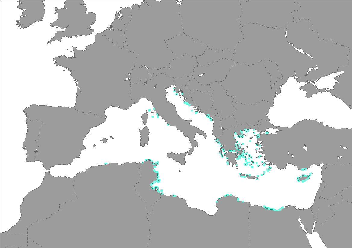
Current Posidonia oceanica meadows distribution (presence points) in the Mediterranean Sea from dataset Seagrass beds distribution along the Mediterranean coasts - Mediterranean Sensitive Habitats (MEDISEH). The dataset of seagrasses distribution across the Mediterranean produced in the framework of MEDISEH derived from the compilation of published and unpublished information.
-

Current Posidonia oceanica meadows distribution (presence points) in the Mediterranean Sea from dataset Seagrass beds distribution along the Mediterranean coasts - Mediterranean Sensitive Habitats (MEDISEH). The dataset of seagrasses distribution across the Mediterranean produced in the framework of MEDISEH derived from the compilation of published and unpublished information. For example literature search was made using mainly the ISI Web of Knowledge engine. At the same time a new search started from the “Bibliographic References” at the end of each paper. We amended the data set with our own unpublished data (grey literature).
-
The layer shows type and location of partners involved in MPA Engage project.
-
The layer shows type and location of partners involved in TUNE UP project.
-
The layer shows type and location of partners involved in the Biodiversity Protection Project . The BBP is an Horizontal Project of the biodiversity protection community funded by the Interreg Med Programme. The BPPproject deals with streamlining networking and management efforts in the Mediterranean region for enhanced natural conservation and protection.
-

Corine Land Cover 2018 (CLC2018) is one of the Corine Land Cover (CLC) datasets produced within the frame the Copernicus Land Monitoring Service referring to land cover / land use status of year 2018. CLC service has a long-time heritage (formerly known as "CORINE Land Cover Programme"), coordinated by the European Environment Agency (EEA). It provides consistent and thematically detailed information on land cover and land cover changes across Europe. CLC datasets are based on the classification of satellite images produced by the national teams of the participating countries - the EEA members and cooperating countries (EEA39). National CLC inventories are then further integrated into a seamless land cover map of Europe. The resulting European database relies on standard methodology and nomenclature with following base parameters: 44 classes in the hierarchical 3-level CLC nomenclature; minimum mapping unit (MMU) for status layers is 25 hectares; minimum width of linear elements is 100 metres. Change layers have higher resolution, i.e. minimum mapping unit (MMU) is 5 hectares for Land Cover Changes (LCC), and the minimum width of linear elements is 100 metres. The CLC service delivers important data sets supporting the implementation of key priority areas of the Environment Action Programmes of the European Union as e.g. protecting ecosystems, halting the loss of biological diversity, tracking the impacts of climate change, monitoring urban land take, assessing developments in agriculture or dealing with water resources directives. CLC belongs to the Pan-European component of the Copernicus Land Monitoring Service (https://land.copernicus.eu/), part of the European Copernicus Programme coordinated by the European Environment Agency, providing environmental information from a combination of air- and space-based observation systems and in-situ monitoring. Additional information about CLC product description including mapping guides can be found at https://land.copernicus.eu/user-corner/technical-library/. CLC class descriptions can be found at https://land.copernicus.eu/user-corner/technical-library/corine-land-cover-nomenclature-guidelines/html/.
