
denominator
10000
160 record(s)
Type of resources
Available actions
Topics
Keywords
Contact for the resource
Provided by
Years
Formats
Representation types
Update frequencies
Status
Scale
panaceaKeywords
GEMET keywords
-
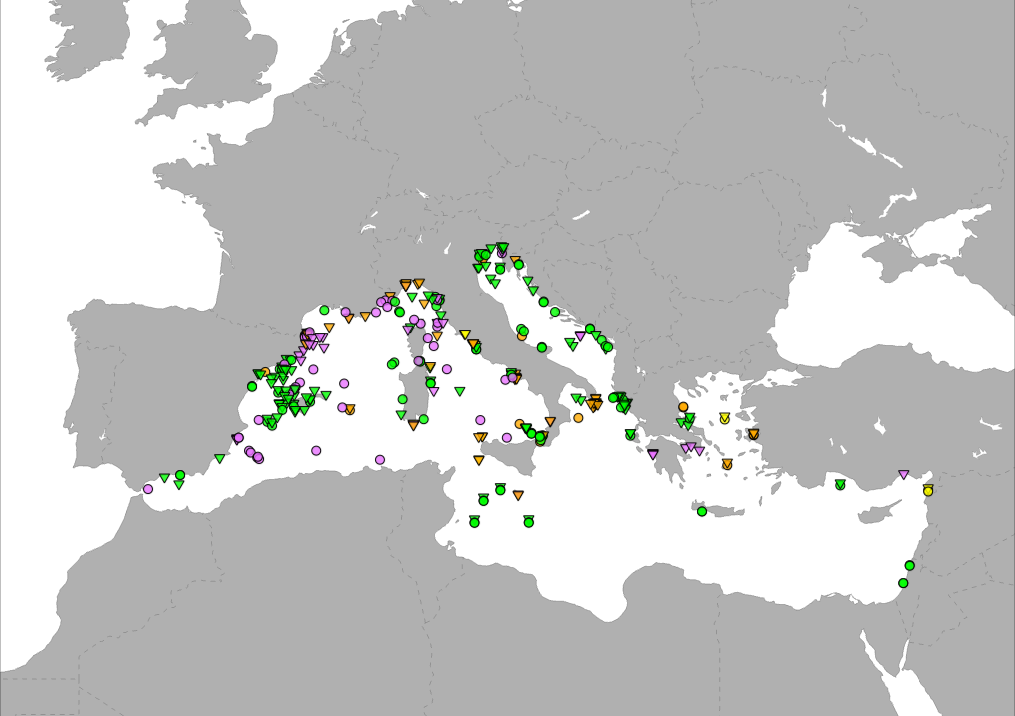
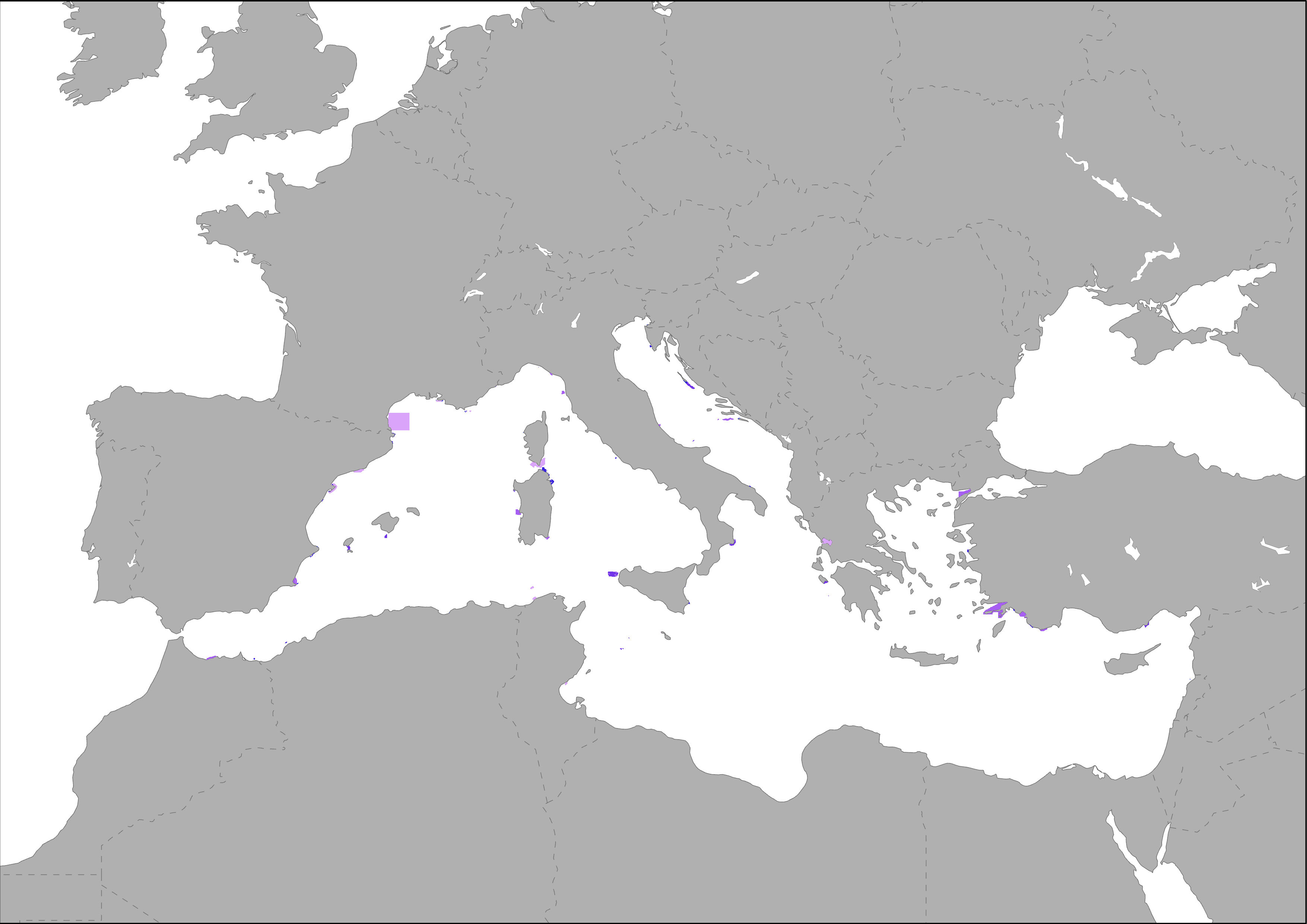
Medbiolitter database summarises results of scientific studies on biodiversity and marine litter interactions in the Mediterranean Sea. To this end, information is collected from different data sources, such as institutions or projects, as well as peer-reviewed publications. The main source of data currently is LITTERBASE/AWI, including only the coverage within the Mediterranean. The database currently comprises 393 records on interactions. Interaction refers to encounters between wildlife and litter items and are classified in four categories: 1) Ingestion, which is the most frequently observed interaction, followed by 2) entanglement, which affects motility, often with fatal consequences, 3) colonization, which occurs when many species settle on floating litter, and 4) others, including different types of less frequent interaction. The database includes among others the location, the type of interaction and litter, marine realm (beach, sea surface, water column, seafloor), habitat, species, whether it occurs in a marine protected area and the type in such case, as well as references to the publication from which the data are extracted. The layer is represented in different ways in the MED Biodiversity platform: 1) Marine litter and biodiversity interactions: it shows the database by type of interaction (ingestion, entanglement, colonization and other) and marine realm (pelagic or benthic). 2) Knowledge update from Nov 2008: changes in the number of records since the last update. It tries to represent the efforts of the PANACeA project to gather additional information on the Mediterranean Sea. 3) Marine litter knowledge from 1988 to 2019: shows the years of publication of the source of the records in the database. In recent dates, especially since 2015, there has been a notable increase in the number of publications related to marine litter.
-
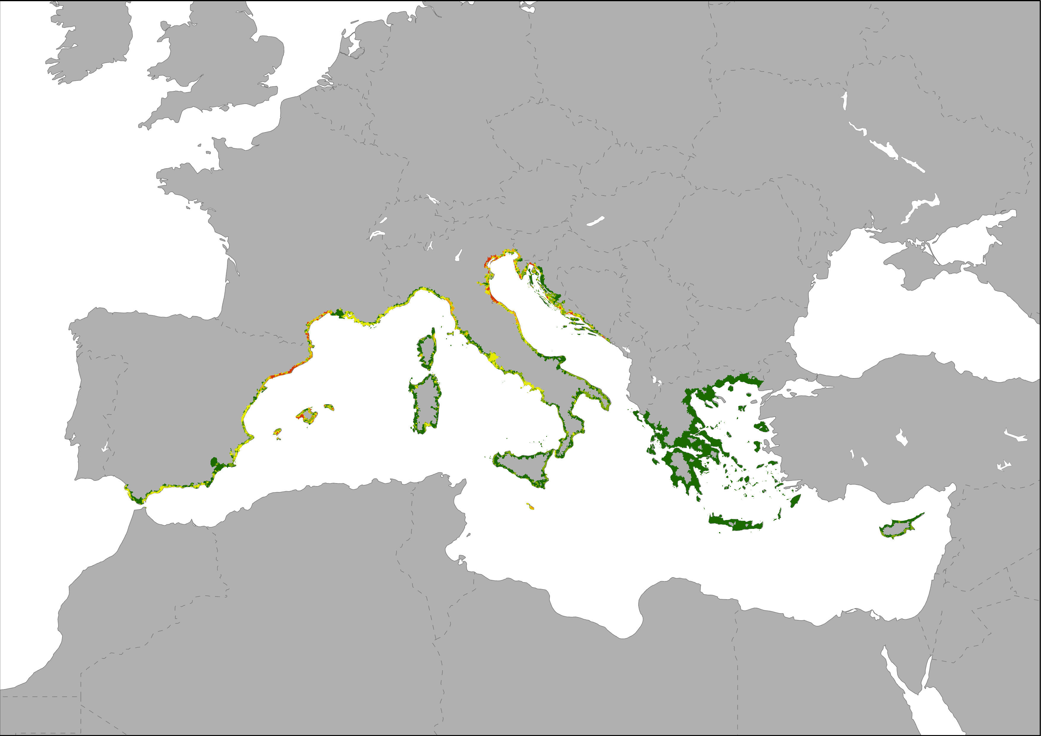
Map showing bed places per km2 as an indicator of the local intensity of tourism capacity. This index is based on Eurostat tourism statistic on bed places and the DMSP-OLS Nighttime Lights Time Series image. Eurostat's tourism capacity statistics differentiate between coastal and non-coastal areas within a NUTS2 region. The total number of beds in coastal areas of a NUTS2 region was disaggregated to the most intense nighttime light emission pixels of the Nighttime Lights Time Series assuming that most bed places are located in areas with high nighttime light emissions. Results are showing low to high intensive tourism capacity per km2 pixel.
-
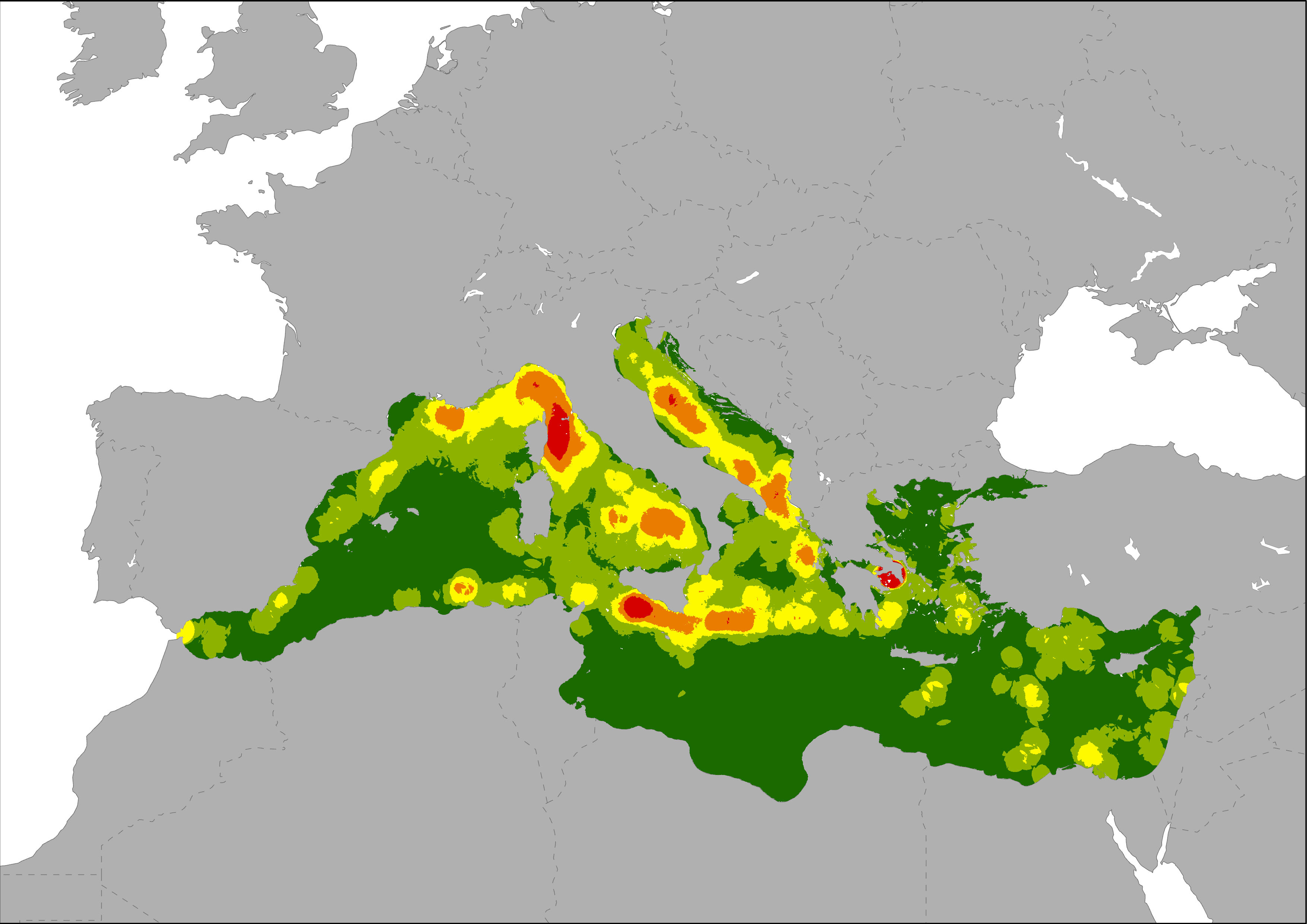
The map shows the spatial distribution of the frequency of oil spills in the Mediterranean Sea, indicating where the probability of an oil discharge is higher. Oil spills were represented as a density layer calculated using data on ship accidents and oil discharges registered by the Mandate of the Regional Marine Pollution Emergency Response Centre for the Mediterranean Sea (REMPEC), and also the oil spills map generated by Cinirella et al., 2012 (based on JRC data, 2009).
-
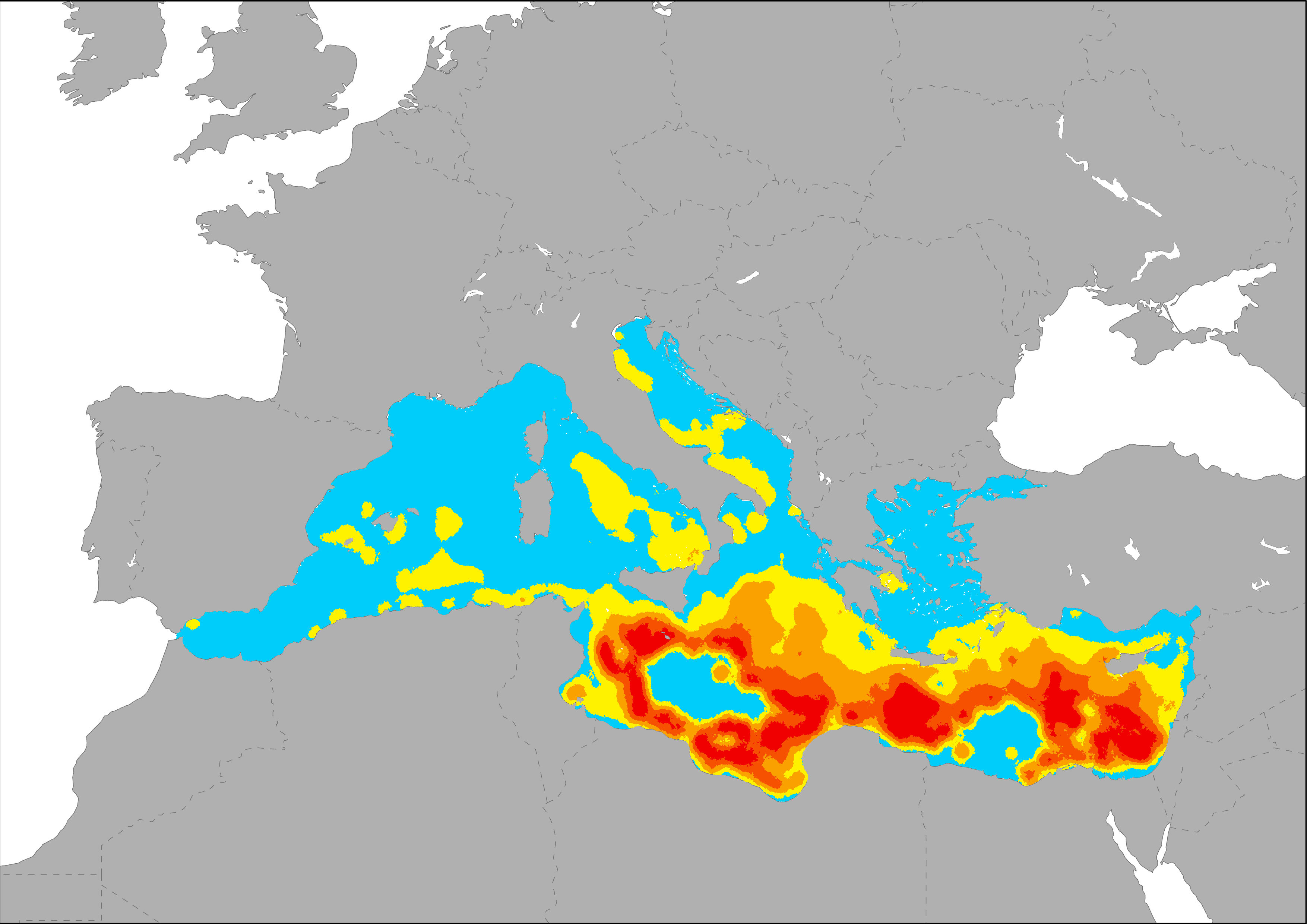
The indicators represent the distribution and degree of accumulation of marine in the Mediterranean Sea. Main source data were modelled by Lebreton et al., 2012 using a Lagrangian particle tracking model to simulate 30 years of input and transport of floating debris in the world’s ocean. The relative contribution of different sources to the total amount was taken into account in their model.
-
The indicator of management effort was made by summing all the overlapping MPAs on each 1ha pixel across the whole Mediterranean Sea (based on MAPAMED, the database on Mediterranean Marine Protected Areas, MedPAN, RAC/SPA, 2014). One to three points were given to each 1ha-pixel inside MPAs according to the increasing densities of permanent staff and boats for research and surveillance in the MPA; one point was given to all the pixels inside MPAs with management plans (Management effort index). Management effort scores varied from zero to seven.
-
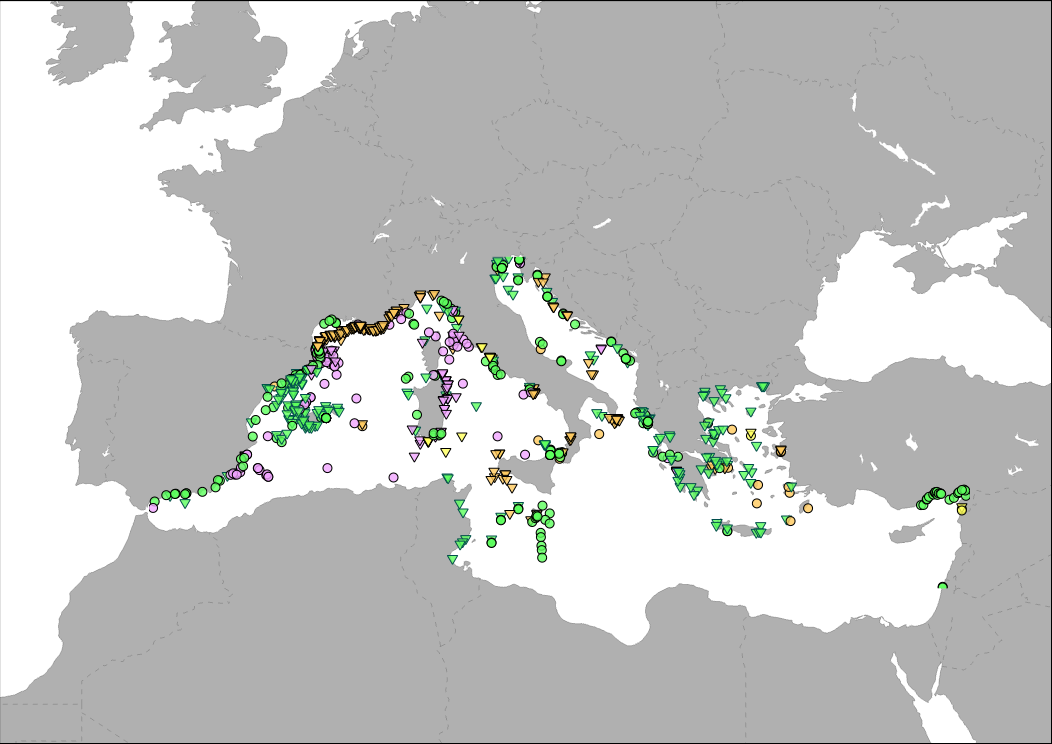
Medbiolitter database summarises results of scientific studies on biodiversity and marine litter interactions in the Mediterranean Sea. To this end, information is collected from different data sources, such as institutions or projects, as well as peer-reviewed publications. One of the main sources of data is LITTERBASE/AWI, only including the coverage within the Mediterranean Sea. The database currently comprises 1056 records on interactions. Interaction refers to encounters between wildlife and litter items and are classified in four categories: 1) Ingestion, which is the most frequently observed interaction, followed by 2) entanglement, which affects motility, often with fatal consequences, 3) colonization, which occurs when many species settle on floating litter, and 4) others, including different types of less frequent interaction. The database includes among others the location, the type of interaction and litter, marine realm (beach, sea surface, water column, seafloor), habitat, species, whether it occurs in a marine protected area and the type in such case, as well as references to the publication from which the data are extracted.
-

Medbiolitter database summarises results of scientific studies on biodiversity and marine litter interactions in the Mediterranean Sea. To this end, information is collected from different data sources, such as institutions or projects, as well as peer-reviewed publications. The main source of data currently is LITTERBASE/AWI, including only the coverage within the Mediterranean. The database currently comprises 393 records on interactions. Interaction refers to encounters between wildlife and litter items and are classified in four categories: 1) Ingestion, which is the most frequently observed interaction, followed by 2) entanglement, which affects motility, often with fatal consequences, 3) colonization, which occurs when many species settle on floating litter, and 4) others, including different types of less frequent interaction. The database includes among others the location, the type of interaction and litter, marine realm (beach, sea surface, water column, seafloor), habitat, species, whether it occurs in a marine protected area and the type in such case, as well as references to the publication from which the data are extracted. The layer is represented in different ways in the MED Biodiversity platform: 1) Marine litter and biodiversity interactions: it shows the database by type of interaction (ingestion, entanglement, colonization and other) and marine realm (pelagic or benthic). 2) Knowledge update from Nov 2008: changes in the number of records since the last update. It tries to represent the efforts of the PANACeA project to gather additional information on the Mediterranean Sea. 3) Marine litter knowledge from 1988 to 2019: shows the years of publication of the source of the records in the database. In recent dates, especially since 2015, there has been a notable increase in the number of publications related to marine litter.
-
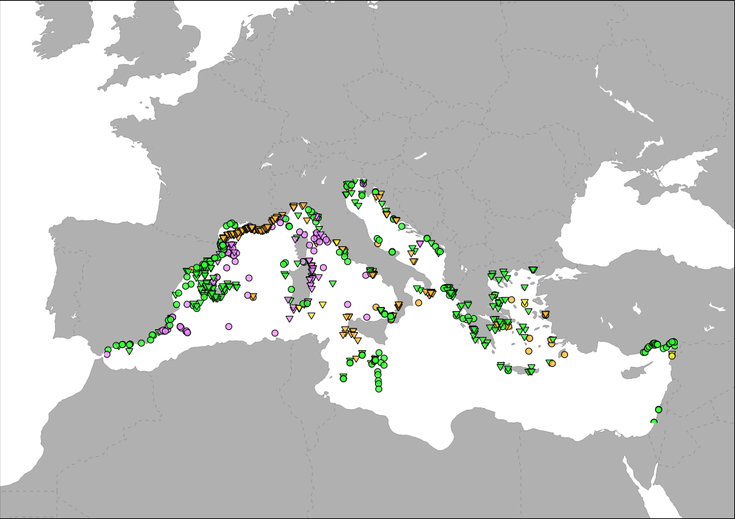
Medbiolitter database summarises results of scientific studies on biodiversity and marine litter interactions in the Mediterranean Sea. To this end, information is collected from different data sources, such as institutions or projects, as well as peer-reviewed publications. The main source of data currently is LITTERBASE/AWI, including only the coverage within the Mediterranean. The database currently comprises 754 records on interactions. Interaction refers to encounters between wildlife and litter items and are classified in four categories: 1) Ingestion, which is the most frequently observed interaction, followed by 2) entanglement, which affects motility, often with fatal consequences, 3) colonization, which occurs when many species settle on floating litter, and 4) others, including different types of less frequent interaction. The database includes among others the location, the type of interaction and litter, marine realm (beach, sea surface, water column, seafloor), habitat, species, whether it occurs in a marine protected area and the type in such case, as well as references to the publication from which the data are extracted. The layer is represented in different ways in the MED Biodiversity platform: 1) Marine litter and biodiversity interactions: it shows the database by type of interaction (ingestion, entanglement, colonization and other) and marine realm (pelagic or benthic). 2) Knowledge update: changes in the number of records in each database version. It tries to represent the efforts of the PANACeA project to gather additional information on the Mediterranean Sea. 3) Marine litter knowledge from 1988 to present date: shows the years of publication of the source of the records in the database. In recent dates, especially since 2015, there has been a notable increase in the number of publications related to marine litter.
-

The Marine Protected Area Protection Framework (MaPAF; Rodríguez-Rodríguez et al., 2016) was adapted to update progress on the protection of Pelagos Sanctuary marine biodiversity. Accordingly, protection was conceived as an additive process entailing two complementary factors: 1. Legal protection and 2. Managerial protection. Legal protection was assessed through two indicators: 1.1. Legal designation (this specific layer), contributing to protection coverage targets, and 1.2. Regulation stringency, contributing to strict protection targets. Managerial protection was assessed via two indicators: 2.1. Existence of a management authority for the site, and 2.2. Existence of a management plan that is fully implemented. Both indicators are expected to contribute to effective Marine Protected Areas & Other Effective Area-Based Conservation Measures (OECMs) management targets. Thus, a site can be legally protected (typically, an MPA), by management measures (e.g. an OECM), attaining different degrees of conservation to their biodiversity. Therefore, a site that has been endowed a stringent legal designation category which has an appointed managerial authority that fully implements the site’s management plan is assumed to have greater protection than a site with opposite characteristics.
-
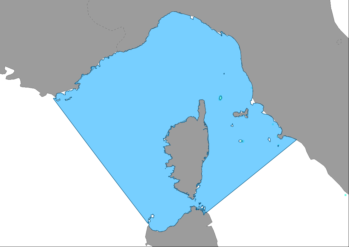
The Marine Protected Area Protection Framework (MaPAF; Rodríguez-Rodríguez et al., 2016) was adapted to update progress on the protection of Pelagos Sanctuary marine biodiversity. Accordingly, protection was conceived as an additive process entailing two complementary factors: 1. Legal protection and 2. Managerial protection. Legal protection was assessed through two indicators: 1.1. Legal designation, contributing to protection coverage targets, and 1.2. Regulation stringency, contributing to strict protection targets. Managerial protection was assessed via two indicators: 2.1. Existence of a management authority for the site (this layer), and 2.2. Existence of a management plan that is fully implemented. Both indicators are expected to contribute to effective Marine Protected Areas & Other Effective Area-Based Conservation Measures (OECMs) management targets. Thus, a site can be legally protected (typically, an MPA), by management measures (e.g. an OECM), attaining different degrees of conservation to their biodiversity. Therefore, a site that has been endowed a stringent legal designation category which has an appointed managerial authority that fully implements the site’s management plan is assumed to have greater protection than a site with opposite characteristics.