
Format
GTiff
2 record(s)
Type of resources
Available actions
Topics
Keywords
Contact for the resource
Provided by
Years
Formats
Representation types
Update frequencies
Resolution
GEMET keywords
-
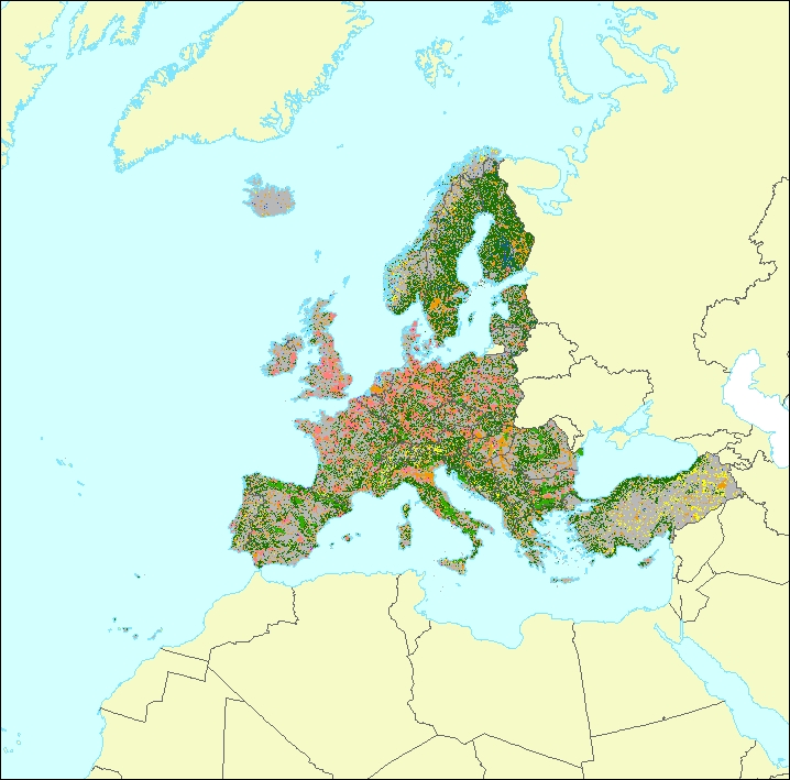
The data set is a secondary product accompanying the terrestrial part of the Ecosystem Type Map 2012 v3.1. It provides supplemental information: • estimated geometric reliability ranging from 1 – 10 (very low to very high) • estimated thematic reliability ranging from 1 – 10 (very low to very high) • Main original LC input data source: - Corine Land Cover - Urban Atlas - Riparian Zones - Natura 2000 (N2k) - High Resolution Layer Forest - High Resolution Layer Grassland - High Resolution Layer Imperviousness - High Resolution Layer Permanent Water Bodies - OpenStreetMap Roads - OpenStreetMap Landuse • MAES Level 2 (Urban, Cropland, Grassland, Woodland and Forest, Heathland and shrub, Sparsely vegetated land, Wetlands, Marine inlets and transitional waters)
-
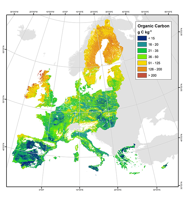
This European Soil Data Centre (ESDAC) dataset provides the maps of Topsoil Soil Organic Carbon in EU-25 (reference year 2014) that are based on LUCAS 2009 soil point data through a generalized additive model. The data provided have been prepared for use by the Land Resource Management Unit (Institute for Environment & Sustainability) of the Joint Research Centre (JRC) of the European Commission. This metadata refers to two maps: a) Map of predicted topsoil organic carbon content (g C kg-1) : The map was produced by fitting a generalised additive model between organic carbon measurements from the LUCAS survey (dependent variable) and a set of selected environmental covariates; namely slope, land cover, annual accumulated temperature, net primary productivity, latitude and longitude. The format provided is GeoTIFF. b) Map of standard error of the OC model predictions (g C kg-1): This map presents the associated uncertainty to the organic carbon content predictions. The standard error, which shows the theoretical range of deviation in the prediction made by the generalized additive model, was calculated for every pixel of the Map of predicted topsoil organic carbon content, based on the posterior covariance matrix of the fitted parameters. The format provided is GeoTIFF. The map of predicted OC content had the smallest values in Mediterranean countries and in croplands across Europe, whereas largest OC contents were predicted in wetlands, woodlands and mountainous areas. The map of the predictions' standard error had large uncertainty in northern latitudes, wetlands, moors and heathlands, whereas small uncertainty was mostly found in croplands. The map produced gives the most updated general picture of topsoil OC content at the European Union scale. IMPORTANT NOTE: this metadata is only for internal EEA use. The original metadata of this dataset prepared by ESDAC can be found here: https://esdac.jrc.ec.europa.eu/content/topsoil-soil-organic-carbon-lucas-eu25. For any problem / question / comment on this dataset, please contact ec-esdac@ec.europa.eu. About ESDAC: a) Panagos P., Van Liedekerke M., Jones A., Montanarella L., “European Soil Data Centre: Response to European policy support and public data requirements”; (2012) Land Use Policy, 29 (2), pp. 329-338. doi:10.1016/j.landusepol.2011.07.003 b) European Soil Data Centre (ESDAC), esdac.jrc.ec.europa.eu, European Commission, Joint Research Centre