
Keyword
Boundaries
74 record(s)
Type of resources
Available actions
Topics
Keywords
Contact for the resource
Provided by
Years
Formats
Representation types
Update frequencies
Status
Scale
Resolution
panaceaKeywords
GEMET keywords
-

Global and regional Canopy Height Maps (CHM). Created using machine learning models on high-resolution worldwide Maxar satellite imagery.
-
This dataset is the definitive set of locality boundaries for the state of Victoria as defined by Local Government and registered by the Registrar of Geographic Names. The boundaries are aligned to Vicmap Property. This dataset is part of the Vicmap Admin dataset series.
-
.PNG)
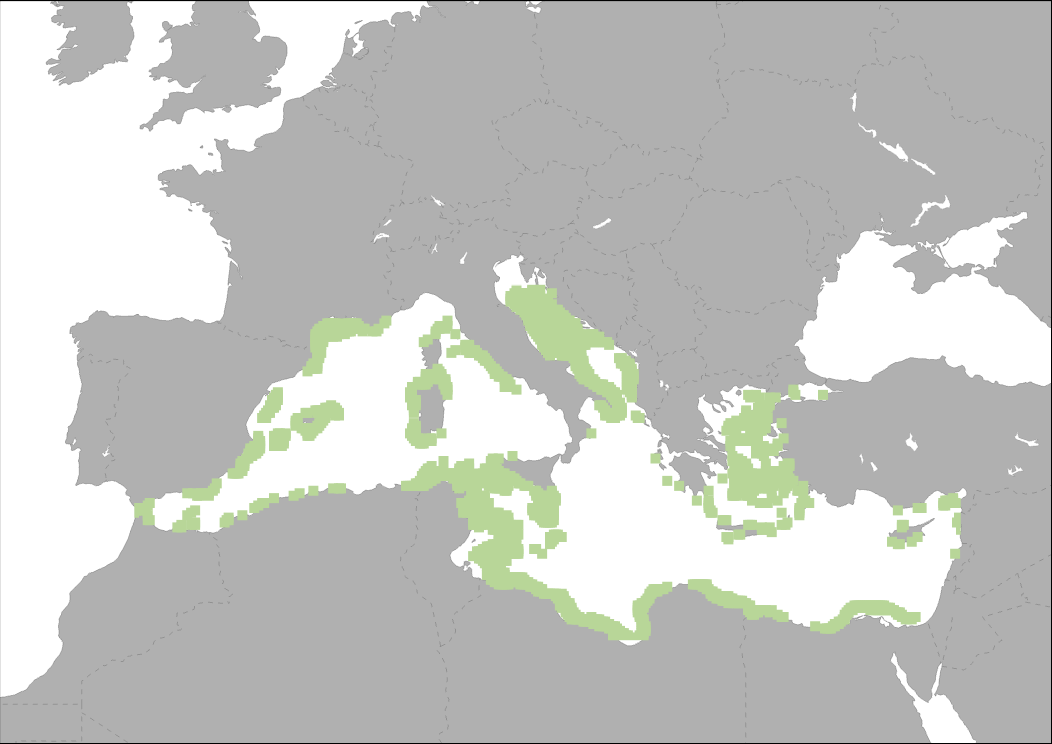
This dataset represents locations and boundaries of MPAs (National MPAs and Natura 2000 sites) along the Northern coasts of Mediterranean Sea. This dataset has been created based on the respective product of MAPAMED (Marine Protected Areas in the Mediterranean) GIS database that gathers information on marine protected areas of the Mediterranean, and more generally on sites of interest to the conservation of the marine environment (url: http://www.mapamed.org). It is developed and jointly administered by the MedPAN association and RAC / SPA. (http://www.mapamed.org). Coverage is the territory of the following EU countries: Spain, France, Italy, Croatia, Greece, Malta, and Cyprus.
-
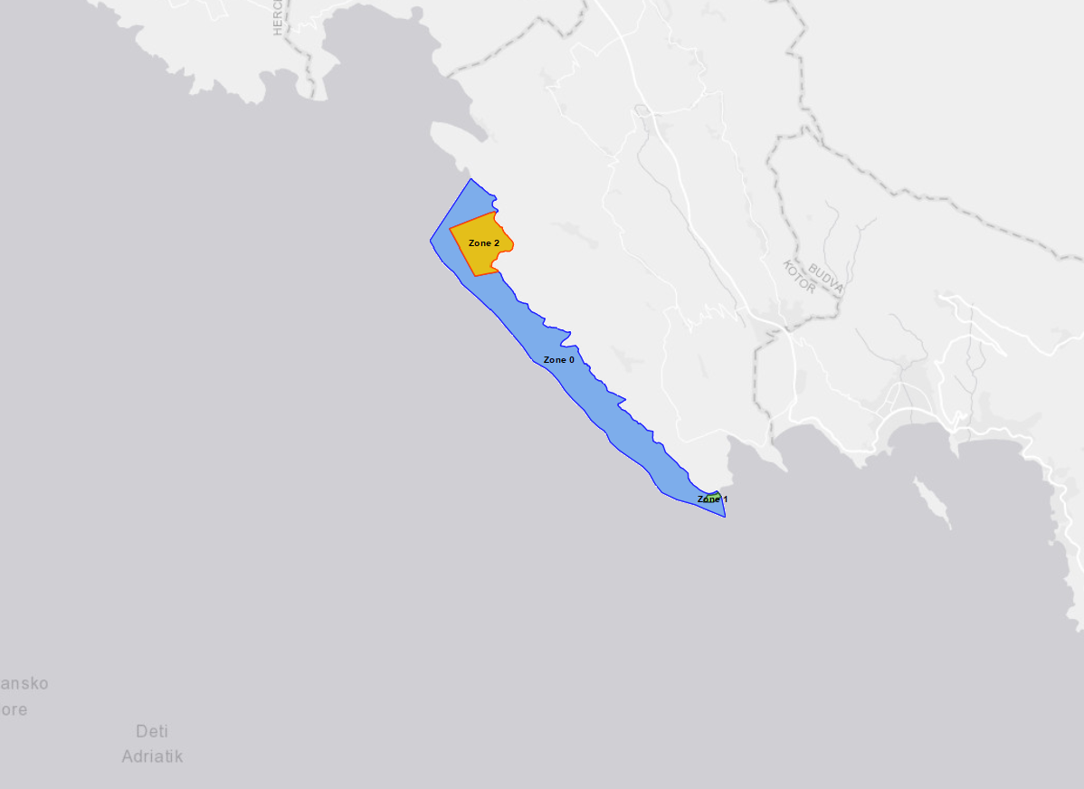
The layer shows the location of Platamuni, first Marine Protected Area in Montenegro which was declared on International Mother Earth Day, 22 April 2021. The Nature Park "Platamuni" is accommodated in the northwest part of the coastal waters in Montenegro, including associated coastline between the Cape Žabica in the northwest and Cape Platamuni in southeast near the beach Ploče. The main reason for proclaiming this first MPA in Montenegro is protecting its ecologically important marine and coastal species and habitats. The Platamuni area is characterized by its main marine cave at the south of Bigova, with at its entrance an extraordinary development of bio-constructions. It also hosts a vast Posidonia oceanica meadow on rock at the western side of Greben Kalafat, continuing by deep coralligenous assemblages on rock. The distribution of caves along the coastline ranges three protected areas: - Zone 0. Platamuni granica zasticenog podrucja - Zone 1. Platamuni II zona zastite morski dio Rt Platamuni - Zone 2. Platamuni II zona zastite morski dio This particular area has benefited in recent years from the support of UNEP/MAP-SPA/RAC, notably through regional projects on marine and coastal protected areas and key habitats mapping in the Mediterranean.
-

The map shows the distribution of main passengers transport ports in the Mediterranean Sea. Ports are classified in groups according to its level of activity.
-
.png)
The map shows the number of moorings in marina ports per kilometre of coastline for each NUTS3 region. Data source: Plan Bleu, Spanish Yachting Port Federation, Portbooker, EEA, 2014.
-
This indicator represent the pressure on coastal ecosystems due to climate change on a scale of 5 classes from very low (1) to very high (5). The assessment of climate change pressure on coastal areas correspond to ESPON Climate indicator 'Aggregate impact of climate change on Europe’s regions'. It is based on a weighted combination of physical, environmental, social, economic and cultural potential impacts of climate change.
-
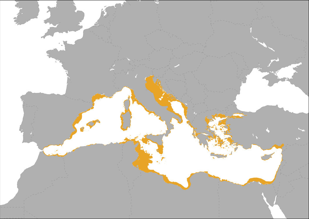
Mediterranean continental plateau (Isobath < 200 m) SOURCE: derived by CNR- ISMAR from Emodnet Bathymetry (2016) EMODnet Bathymetry Consortium (2016): EMODnet Digital Bathymetry (DTM). http://doi.org/10.12770/c7b53704-999d-4721-b1a3-04ec60c87238
-
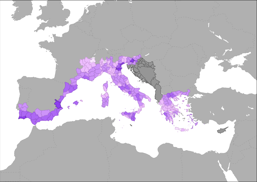
POSBEMED is a Study Project of the biodiversity protection community funded by the Interreg Med Programme. The POSBEMED project deals with "Sustainable management of the systems Posidonia-beaches in the Mediterranean region". The POSBEMED project is addressing topics as GIS database on posidonia meadows, touristic activities and Pas, guidelines for sustainable beach and stranded seagrass management, strategy and action plan for Mediterranean regions and Benchmarking study on management practices for posidonia banquettes/beaches are addressed. This specific map represents the municipalities distribution where the questionnaire on the perceptions about Posidonia banquettes on Mediterranean beaches has been realized.
-
Suitable area for floating Offshore Wind Farms (water depth 50 to 200 m and wind speeds*greater than 5m/sec at 80 m height above sea level) From MEDTRENDS 2015 for PHAROS4MPAs