
Keyword
Hydrography
6 record(s)
Type of resources
Available actions
Topics
Keywords
Contact for the resource
Provided by
Years
Formats
Representation types
Update frequencies
Status
Scale
GEMET keywords
-
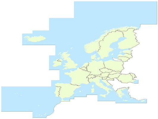
EuroRegionalMap is a Pan-European topographic vector dataset at scale 1: 250000 covering 32 European countries: 26 EU Countries (Bulgaria not included), 4 EFTA countries, the Republic of Moldova and Liechtenstein. It is seamless and harmonized across boundaries.It is a seamless1 and harmonised data and is produced in cooperation by the National Mapping and Cadastral Agencies of Europe, using official national databases. EuroRegionalMap is ideal for a wide range of uses, including cartographic publishing and backdrop visualisation, or in combination with other datasets for marketing planning and socio-economic analysis, environmental analysis, and transport management. Themes: a) Administrative (administrative boundaries, administrative areas) b) Hydrography (well, coastline / shoreline, foreshore, island, sea, aqueduct, lake / pond, reservoir, spring / water hole, waterfall, watercourse, dam / weir, lock, glacier, snow field / ice field, wetland) c) Transportation (railway, interchange of motorways, road, control tower, level crossing, ferry crossing, ferry station, entrance / exit, railway station, vehicle stopping area / rest area, pier / wharf / quay, airport / airfield, heliport, runway) d) Settlements (built-up area, named location)
-
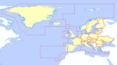
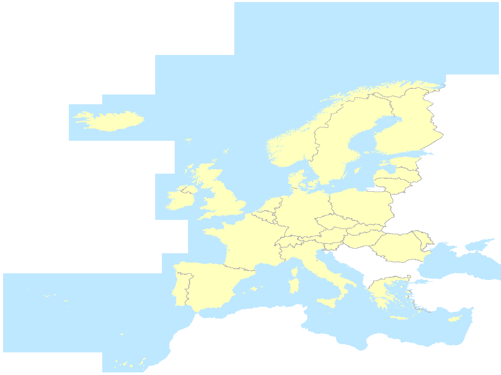
EuroRegionalMap v4.0 is a pan-European dataset containing topo-geographic information at the scale 1:250 000 assembled from 31 country data sets covering 26 EU Countries (Bulgaria not included), 4 EFTA countries, the Republic of Moldova. It is a seamless (there are no gaps between graphical objects initially derived from different sources) and harmonised data and is produced in cooperation by the National Mapping and Cadastral Agencies of Europe, using official national databases. Themes: a) Administrative (administrative boundaries, administrative areas) b) Hydrography (well, coastline / shoreline, foreshore, island, sea, aqueduct, lake / pond, reservoir, spring / water hole, waterfall, watercourse, dam / weir, lock, glacier, snow field / ice field, wetland) c) Transportation (railway, interchange of motorways, road, control tower, level crossing, ferry crossing, ferry station, entrance / exit, railway station, vehicle stopping area / rest area, pier / wharf / quay, airport / airfield, heliport, runway) d) Settlements (built-up area, named location) e) Soil and vegetation
-
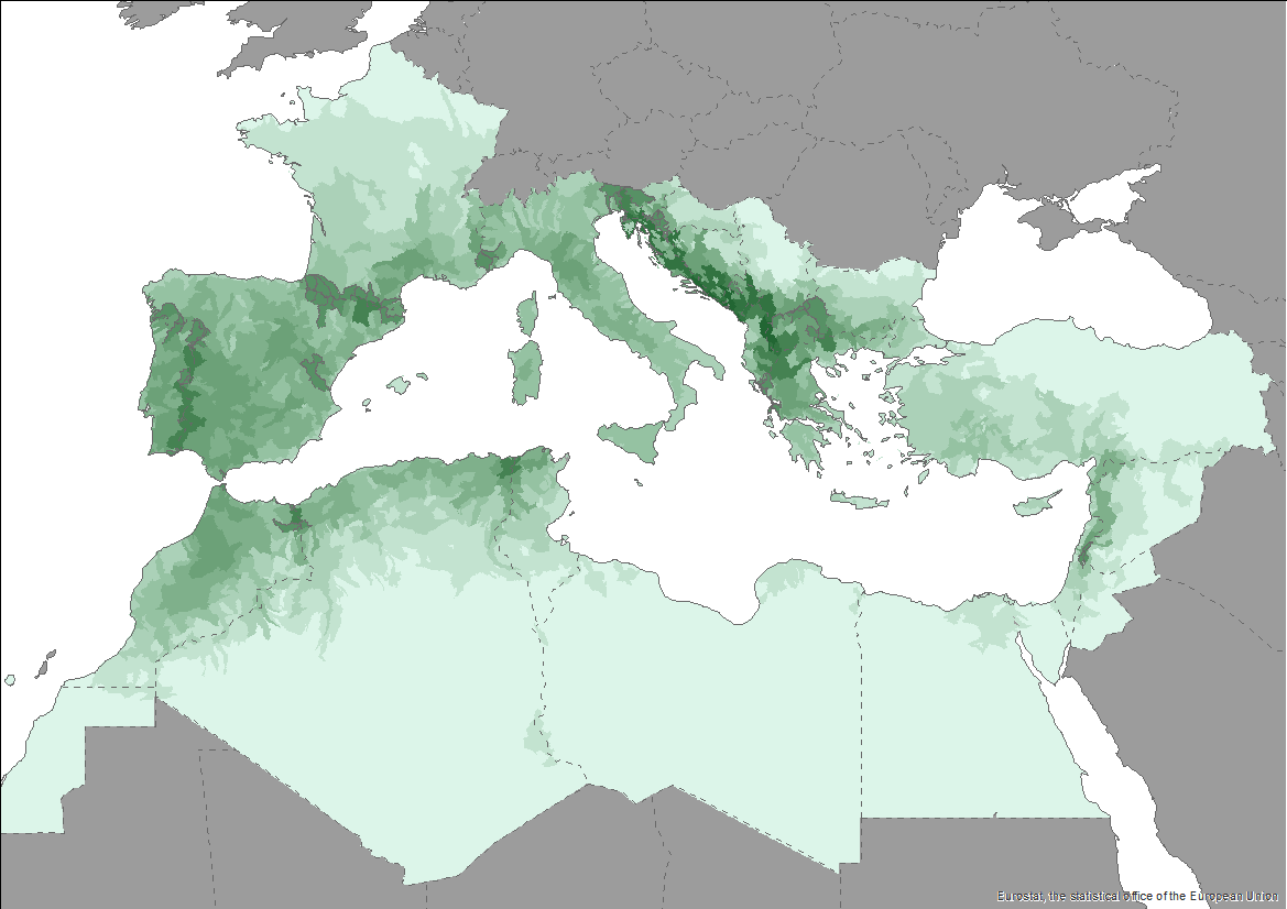
The Pan-Mediterranean wetland knowledge base builds on methods and approaches developed in the framework of on-going efforts at the Mediterranean scale to map wetland ecosystems and assess their condition. It is relevant for several on-going initiatives at a regional, European and global level (e.g. UN Decade on Ecosystem restoration, EU Biodiversity Strategy for 2030, the Barcelona Convention and its protocols on Integrated Coastal Zone Management and Specially Protected Areas). As part of these efforts, ETC-UMA produced an assessment that targets the distribution, state and trends of pressures and impacts on key animal and plant biodiversity hosted by wetland habitats in the Mediterranean region. The assessment of wetland biodiversity conditions aims to complement existing knowledge and address the lack of readily available spatially-explicit information on the areas where biodiversity unique to the Mediterranean occurs, and where endemic biodiversity is most threatened, using data from The Red List of Threatened Species™ of the International Union for Conservation of Nature (IUCN). For the threatened species analysis, only species categorised in the IUCN Red List as Critically Endangered (CR), Endangered (EN) and Vulnerable (VU) were considered. The goal is to highlight priority areas for potential conservation actions in the region, and to support the regional efforts in advocating for effective wetland management and nature-based solutions in the Mediterranean region.
-
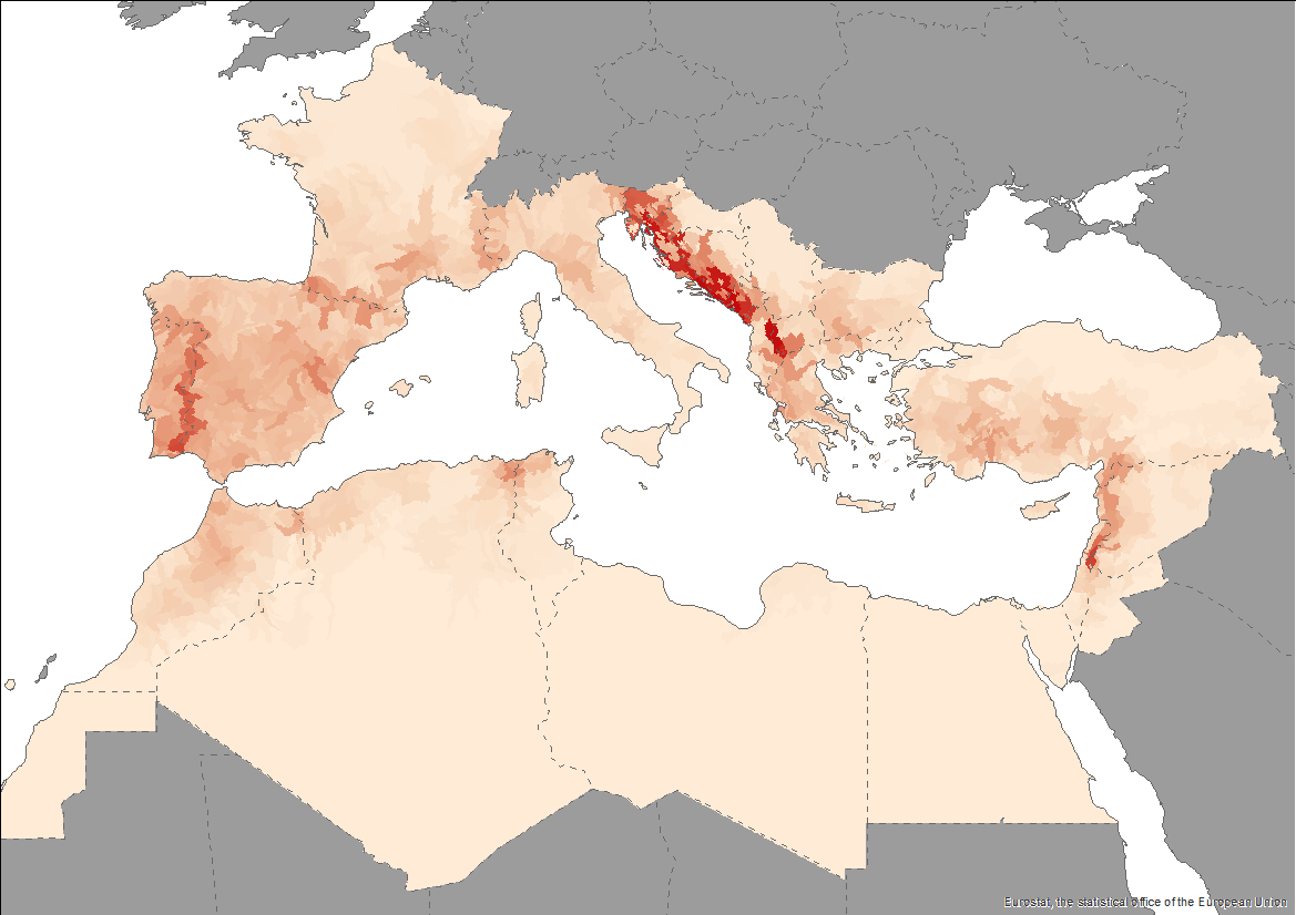
The Pan-Mediterranean wetland knowledge base builds on methods and approaches developed in the framework of on-going efforts at the Mediterranean scale to map wetland ecosystems and assess their condition. It is relevant for several on-going initiatives at a regional, European and global level (e.g. UN Decade on Ecosystem restoration, EU Biodiversity Strategy for 2030, the Barcelona Convention and its protocols on Integrated Coastal Zone Management and Specially Protected Areas). As part of these efforts, ETC-UMA produced an assessment that targets the distribution, state and trends of pressures and impacts on key animal and plant biodiversity hosted by wetland habitats in the Mediterranean region. The assessment of wetland biodiversity conditions aims to complement existing knowledge and address the lack of readily available spatially-explicit information on the areas where biodiversity unique to the Mediterranean occurs, and where endemic biodiversity is most threatened, using data from The Red List of Threatened Species™ of the International Union for Conservation of Nature (IUCN). For the threatened species analysis, only species categorised in the IUCN Red List as Critically Endangered (CR), Endangered (EN) and Vulnerable (VU) were considered. The goal is to highlight priority areas for potential conservation actions in the region, and to support the regional efforts in advocating for effective wetland management and nature-based solutions in the Mediterranean region.
-
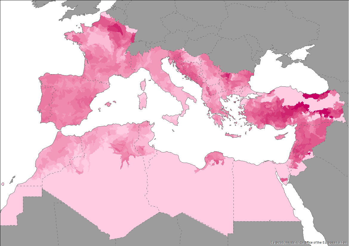
The Pan-Mediterranean wetland knowledge base builds on methods and approaches developed in the framework of on-going efforts at the Mediterranean scale to map wetland ecosystems and assess their condition. It is relevant for several on-going initiatives at a regional, European and global level (e.g. UN Decade on Ecosystem restoration, EU Biodiversity Strategy for 2030, the Barcelona Convention and its protocols on Integrated Coastal Zone Management and Specially Protected Areas). As part of these efforts, ETC-UMA produced an assessment that targets the distribution, state and trends of pressures and impacts on key animal and plant biodiversity hosted by wetland habitats in the Mediterranean region. The assessment of wetland biodiversity conditions aims to complement existing knowledge and address the lack of readily available spatially-explicit information on the areas where biodiversity unique to the Mediterranean occurs, and where endemic biodiversity is most threatened, using data from The Red List of Threatened Species™ of the International Union for Conservation of Nature (IUCN). For the threatened species analysis, only species categorised in the IUCN Red List as Critically Endangered (CR), Endangered (EN) and Vulnerable (VU) were considered. The goal is to highlight priority areas for potential conservation actions in the region, and to support the regional efforts in advocating for effective wetland management and nature-based solutions in the Mediterranean region.