Keyword
PHAROS4MPAs project
12 record(s)
Type of resources
Available actions
Topics
Keywords
Contact for the resource
Provided by
Years
Formats
Representation types
Update frequencies
Status
Scale
panaceaKeywords
GEMET keywords
-
The layer shows type and location of pilot sites involved in PHAROS4MPAs project. PHAROS4MPAs is a Capitalization Project of the biodiversity protection community funded by the Interreg Med Programme. The PHAROS4MPAs project deals with Blue Economy and Marine Conservation: Safeguarding Mediterranean MPAs in order to achieve Good Environmental Status.
-
The layer shows type and location of partners involved in PHAROS4MPAs project. PHAROS4MPAs is a Capitalization Project of the biodiversity protection community funded by the Interreg Med Programme. The PHAROS4MPAs project deals with Blue Economy and Marine Conservation: Safeguarding Mediterranean MPAs in order to achieve Good Environmental Status.
-
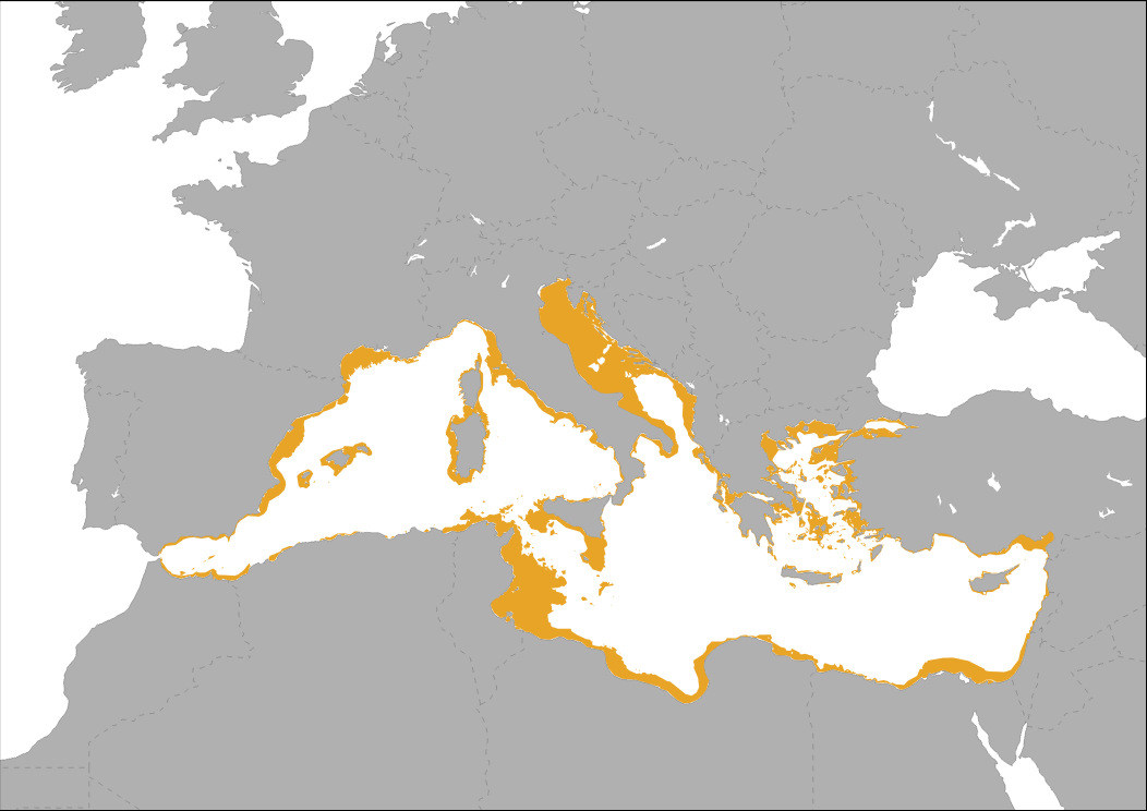
Mediterranean continental plateau (Isobath < 200 m) SOURCE: derived by CNR- ISMAR from Emodnet Bathymetry (2016) EMODnet Bathymetry Consortium (2016): EMODnet Digital Bathymetry (DTM). http://doi.org/10.12770/c7b53704-999d-4721-b1a3-04ec60c87238
-
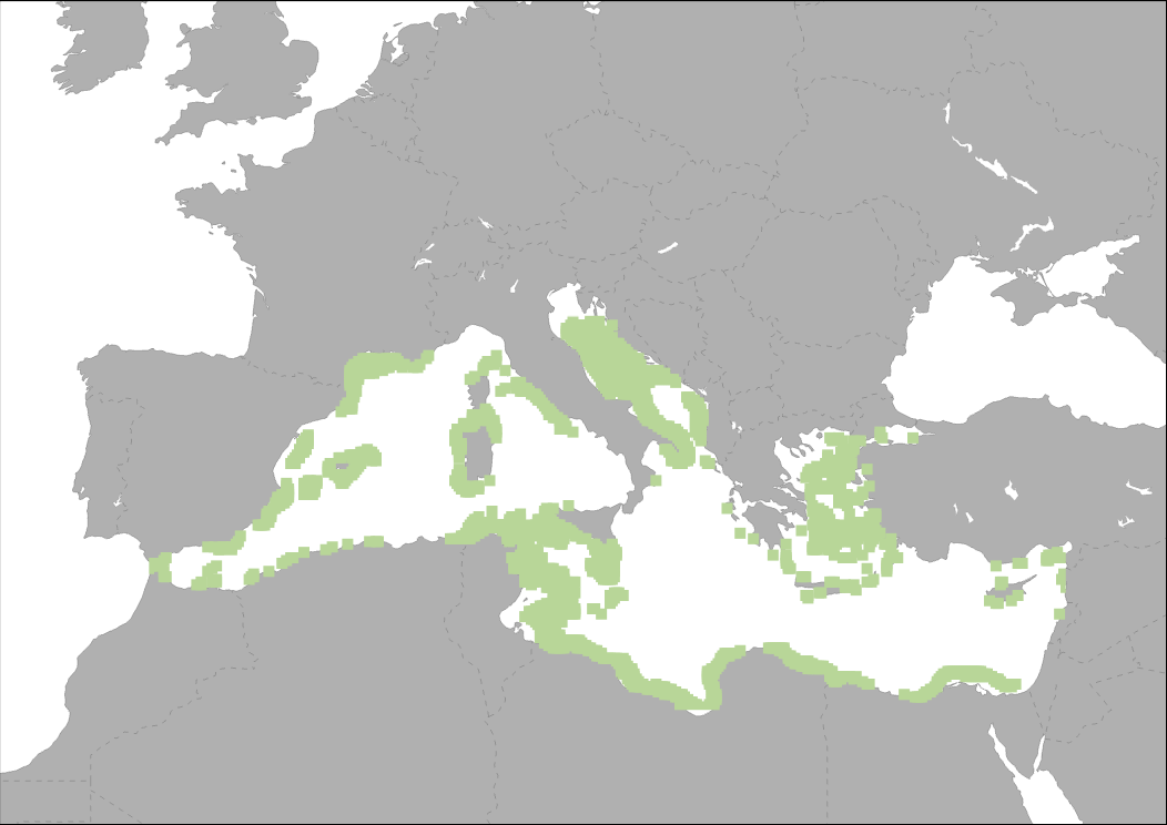
Suitable area for floating Offshore Wind Farms (water depth 50 to 200 m and wind speeds*greater than 5m/sec at 80 m height above sea level) From MEDTRENDS 2015 for PHAROS4MPAs
-
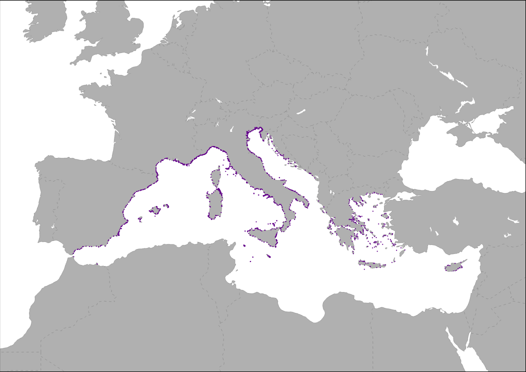
Location of marinas in EU Mediterranean countries, plus Montenegro, Albania, Bosnia and Herzegovina. The identification of port facilities exclusively or partially occupied for leisure activities is not yet possible in the other Mediterranean countries. SOURCE: IFREMER revised by WWF France (2019)
-
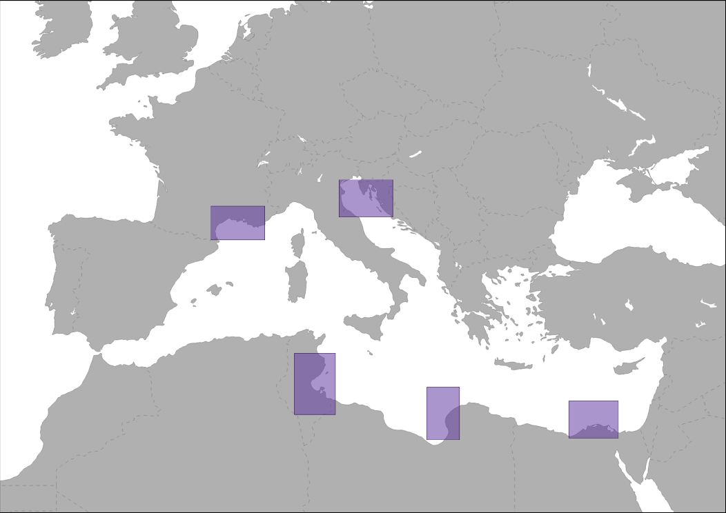
The five OWF hotspots are identified as the Gulf of Lion, the North Adriatic Sea, the Gulfs of Hammamet and Gabès, the Gulf of Sidra, and the Nile Delta. Understanding the species, habitats and taxa that are likely to be affected by the construction and operation of OWFs in these regions and the wider Mediterranean region will assist developers and policy makers with future spatial planning decisions regarding OWFs within the Mediterranean. Furthermore, the advancement and implementation of floating wind turbine technology may diminish many of the above mentioned effects, which, from this point of view, is a very promising perspective for the near future. OWF Potential hotspot areas. SOURCE: Bray, L.; Reizopoulou, S.; Voukouvalas, E.; Soukissian, T.; Alomar, C.; Vázquez-Luis, M.; Deudero, S.; Attrill, M.; Hall-Spencer, J. Expected effects of offshore wind farms on mediterranean marine life. J. Mar. Sci. Eng. 2016, 4, 18. https://www.mdpi.com/2077-1312/4/1/18.
-
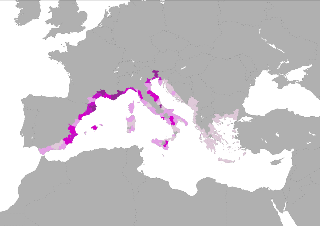
Marina port capacity shown by number of moorings per km of coastline in EU countries. SOURCE: Elabopration by WWF from Dominique Billé and Christophe Lowezanin (2011): http://docplayer.net/11264740-Yachting-centres-in-the-mediterranean.html and European Environment Agency (2017) for NUTS
-
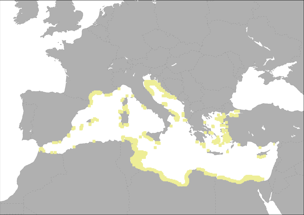
Suitable area for fixed OWF (water depth < 50 m and wind speeds*greater than 5m/sec at 80 m height above sea level) From MEDTRENDS 2015
-
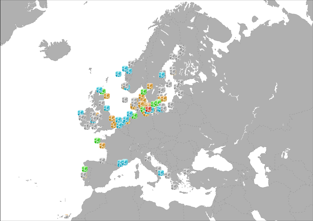
The database on offshore wind farms in the EU was created in 2014 by CETMAR for the European Marine Observation and Data Network (EMODnet). It is the result of the aggregation and harmonization of datasets provided by several sources. It is updated every year and is available for viewing and download on EMODnet Human Activities web portal (www.emodnet-humanactivities.eu). The database contains points and/or (where available) polygons representing offshore wind farms in the following countries: Belgium, Denmark, Estonia, Finland, France, Germany, Greece, Ireland, Italy, Latvia, Lithuania, Netherlands, Norway, Poland, Portugal, Spain, Sweden and United Kingdom. Each point has the following attributes (where available): Name, Nº of turbines, Status (Approved, Planned, Dismantled, Construction, Production, Test site), Country, Year, Power (MW), Distance to coast (metres) and Area (square kilometres). The distance to coast (EEA coastline shapefile) has been calculated using the UTM WGS84 Zone projected coordinate system where data fall in
-
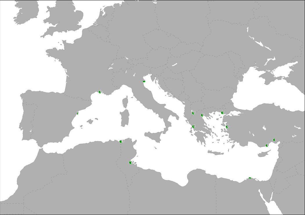
Location of main Mediterranean wetland areas. SOURCE: Bray, L.; Reizopoulou, S.; Voukouvalas, E.; Soukissian, T.; Alomar, C.; Vázquez-Luis, M.; Deudero, S.; Attrill, M.; Hall-Spencer, J. Expected effects of offshore wind farms on mediterranean marine life. J. Mar. Sci. Eng. 2016, 4, 18. https://www.mdpi.com/2077-1312/4/1/18
