Keyword
wetland
5 record(s)
Type of resources
Available actions
Topics
Keywords
Contact for the resource
Provided by
Years
Formats
Representation types
Update frequencies
Status
Scale
panaceaKeywords
GEMET keywords
-

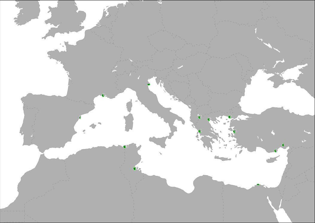
Location of main Mediterranean wetland areas. SOURCE: Bray, L.; Reizopoulou, S.; Voukouvalas, E.; Soukissian, T.; Alomar, C.; Vázquez-Luis, M.; Deudero, S.; Attrill, M.; Hall-Spencer, J. Expected effects of offshore wind farms on mediterranean marine life. J. Mar. Sci. Eng. 2016, 4, 18. https://www.mdpi.com/2077-1312/4/1/18
-

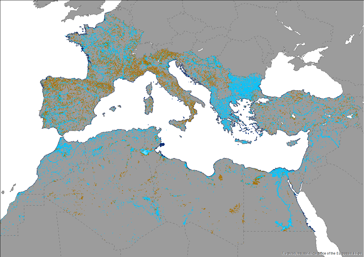
This knowledge base builds on methods and approaches developed in the framework of on-going efforts at the Mediterranean scale to map wetland ecosystems and assess their condition. It is relevant for several on-going initiatives at a regional, European and global level (e.g. UN Decade on Ecosystem restoration, EU Biodiversity Strategy for 2030, the Barcelona Convention and its protocols on Integrated Coastal Zone Management and Specially Protected Areas). The development of the products presented in this report was carried out through a collaborative process that aimed to engage key players and stakeholders working on different aspects and scales of wetland mapping and habitat identification in the Mediterranean region. The Pan-Mediterranean wetland knowledge base constitutes the first step in building and making available a harmonised knowledge base across the whole region on the spatial extent, distribution and type of wetlands in the Mediterranean region. Despite the amount of data ingested and the variety of contributors, large areas of the whole basin still lack detailed and reliable regional data, which makes the final Pan-Mediterranean wetlands map worth improving as data and knowledge becomes more available and accessible over time. Further efforts are needed to identify available higher resolution data for specific areas.
-

This knowledge base builds on methods and approaches developed in the framework of on-going efforts at the Mediterranean scale to map wetland ecosystems and assess their condition. It is relevant for several on-going initiatives at a regional, European and global level (e.g. UN Decade on Ecosystem restoration, EU Biodiversity Strategy for 2030, the Barcelona Convention and its protocols on Integrated Coastal Zone Management and Specially Protected Areas). The development of the products presented in this report was carried out through a collaborative process that aimed to engage key players and stakeholders working on different aspects and scales of wetland mapping and habitat identification in the Mediterranean region. The Pan-Mediterranean wetland knowledge base constitutes the first step in building and making available a harmonised knowledge base across the whole region on the spatial extent, distribution and type of wetlands in the Mediterranean region. Despite the amount of data ingested and the variety of contributors, large areas of the whole basin still lack detailed and reliable regional data, which makes the final Pan-Mediterranean wetlands map worth improving as data and knowledge becomes more available and accessible over time. Further efforts are needed to identify available higher resolution data for specific areas.
-

This knowledge base builds on methods and approaches developed in the framework of on-going efforts at the Mediterranean scale to map wetland ecosystems and assess their condition. It is relevant for several on-going initiatives at a regional, European and global level (e.g. UN Decade on Ecosystem restoration, EU Biodiversity Strategy for 2030, the Barcelona Convention and its protocols on Integrated Coastal Zone Management and Specially Protected Areas). The development of the products presented in this report was carried out through a collaborative process that aimed to engage key players and stakeholders working on different aspects and scales of wetland mapping and habitat identification in the Mediterranean region. The Pan-Mediterranean wetland knowledge base constitutes the first step in building and making available a harmonised knowledge base across the whole region on the spatial extent, distribution and type of wetlands in the Mediterranean region. Despite the amount of data ingested and the variety of contributors, large areas of the whole basin still lack detailed and reliable regional data, which makes the final Pan-Mediterranean wetlands map worth improving as data and knowledge becomes more available and accessible over time. Further efforts are needed to identify available higher resolution data for specific areas.
-

This knowledge base builds on methods and approaches developed in the framework of on-going efforts at the Mediterranean scale to map wetland ecosystems and assess their condition. It is relevant for several on-going initiatives at a regional, European and global level (e.g. UN Decade on Ecosystem restoration, EU Biodiversity Strategy for 2030, the Barcelona Convention and its protocols on Integrated Coastal Zone Management and Specially Protected Areas). The development of the products presented in this report was carried out through a collaborative process that aimed to engage key players and stakeholders working on different aspects and scales of wetland mapping and habitat identification in the Mediterranean region. The Pan-Mediterranean wetland knowledge base constitutes the first step in building and making available a harmonised knowledge base across the whole region on the spatial extent, distribution and type of wetlands in the Mediterranean region. Despite the amount of data ingested and the variety of contributors, large areas of the whole basin still lack detailed and reliable regional data, which makes the final Pan-Mediterranean wetlands map worth improving as data and knowledge becomes more available and accessible over time. Further efforts are needed to identify available higher resolution data for specific areas.
