
Contact for the resource
ISPRA
2 record(s)
Type of resources
Available actions
Topics
Keywords
Contact for the resource
Provided by
Representation types
Update frequencies
Status
Scale
panaceaKeywords
GEMET keywords
-
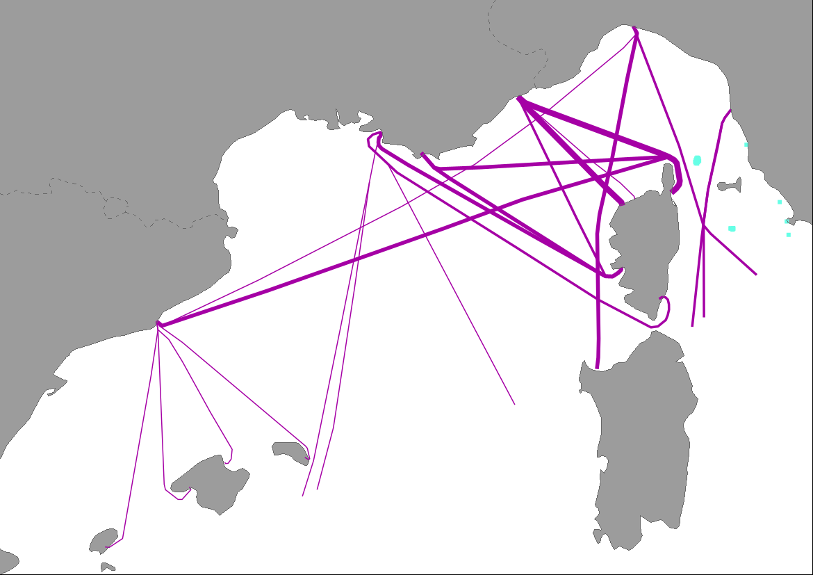
This data provides an analysis considering the Collision risk between ships and whales within the proposed north-western Mediterranean Particularly Sensitive Sea Area (PSSA). Specifically, are combined the maritime traffic for passenger ships and cargos to routes (Vessel density, Emodnet) with the highest number of recorded whale ship strikes (International Whaling Commission ship strike database). Further information is available on the factsheet “the pathways to coexistence between large cetaceans and maritime transport in the north-western Mediterranean region” [Pathways-to-coexistence-between-large-cetaceans-and-maritime-transport-in-the-north-western-Mediterranean-region.pdf (uma.es)], prepared within the framework of the Interreg Med Mediterranean Biodiversity Protection Community project, 2019-2022.
-
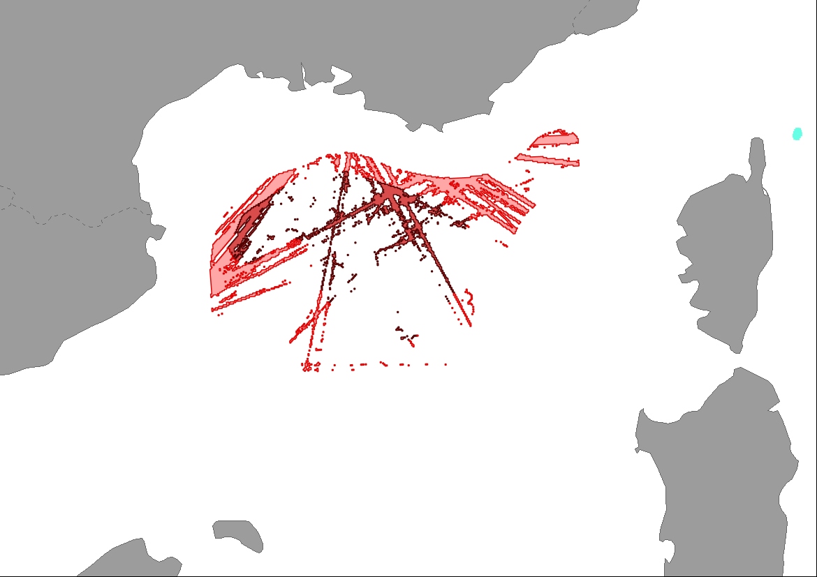
This data provides an analysis considering the pressure of maritime traffic on fin whales within the proposed north-western Mediterranean Particularly Sensitive Sea Area (PSSA). The resulting map shows two types of areas with different level of potential risk of collision in summer: 1) Sensitive zones: overlap of high traffic intensity with medium whale densities; 2) Restriction zones: overlap of high traffic intensity with high whale densities. Further information is available on the factsheet “the pathways to coexistence between large cetaceans and maritime transport in the north-western Mediterranean region”[ Pathways-to-coexistence-between-large-cetaceans-and-maritime-transport-in-the-north-western-Mediterranean-region.pdf (uma.es)], prepared within the framework of the Interreg Med Mediterranean Biodiversity Protection Community project, 2019-2022.